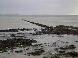
Mid Taing, Orkney Islands

« Gazetteer Entry
Upload Photo

Mid Taing, Orkney Islands

  • Unitary Authority: Orkney Islands
  • Region: Scotland
  • Category: Geographic Feature
  • Type: Other Coastal Landform
  • Latitude/Longitude: 58°57'19"N 2°59'29"W
  • Eastings/Northings: 343060, 1008010
  • OS Grid: HY430080
  • Mapcode Local: GBR L5Z1.VPV
  • Mapcode Global: WH7CB.05QG

Location and coordinates are for the approximate centre of Mid Taing within this administrative area. Geographic features and populated places may cross administrative borders.

BritishPlaceNames.uk is a Good Stuff website.