-

Malacleit/North Uist - 1981
-
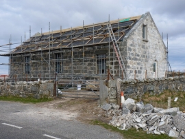
Re-roofing the church at Malacleit
Malacleit/North Uist - 1981
Re-roofing the church at Malacleit
Other current and historical names
Location and coordinates are for the approximate centre of Malacleit within this administrative area. Geographic features and populated places may cross administrative borders.