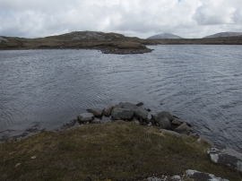
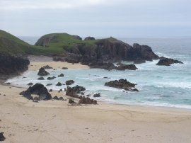
Loch na Caolan, Na h-Eileanan Siar

« Gazetteer Entry
Upload Photo

Loch na Caolan, Na h-Eileanan Siar

  • Unitary Authority: Na h-Eileanan Siar
  • Region: Scotland
  • Category: Water Feature
  • Type: Inland Water
  • Latitude/Longitude: 58°9'29"N 7°5'11"W
  • Eastings/Northings: 100939, 930104
  • OS Grid: NB009301
  • Mapcode Local: GBR 87W5.4YK
  • Mapcode Global: WGW0R.36SP

Location and coordinates are for the approximate centre of Loch na Caolan within this administrative area. Geographic features and populated places may cross administrative borders.

BritishPlaceNames.uk is a Good Stuff website.