-

Old brick pit near Eye , Peterborough
-
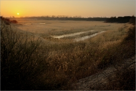
Dogsthorpe Star Pit Local Nature Reserve
Old brick pit near Eye , Peterborough
Dogsthorpe Star Pit Local Nature Reserve
Location and coordinates are for the approximate centre of Little Wood within this administrative area. Geographic features and populated places may cross administrative borders.