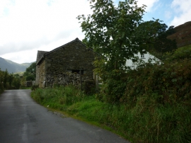
Little Langdale Tarn, Cumbria

« Gazetteer Entry
Upload Photo

Little Langdale Tarn, Cumbria

  • Parish/Community: Lakes
  • District/Borough: South Lakeland
  • County: Cumbria
  • Region: North West
  • Category: Water Feature
  • Type: Other Water Feature
  • Latitude/Longitude: 54°25'19"N 3°4'21"W
  • Eastings/Northings: 330500, 503500
  • OS Grid: NY305035
  • Mapcode Local: GBR 6KZ9.LK
  • Mapcode Global: WH716.S31Q

Location and coordinates are for the approximate centre of Little Langdale Tarn within this administrative area. Geographic features and populated places may cross administrative borders.

BritishPlaceNames.uk is a Good Stuff website.