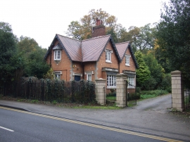
Lake Hill Wood, Nottinghamshire

« Gazetteer Entry
Upload Photo

Lake Hill Wood, Nottinghamshire

  • Built-Up Area: Retford
  • Parish/Community: Bassetlaw, unparished area
  • District/Borough: Bassetlaw
  • County: Nottinghamshire
  • Region: East Midlands
  • Category: Landcover
  • Type: Forest or Wood
  • Latitude/Longitude: 53°19'9"N 0°57'55"W
  • Eastings/Northings: 469015, 380768
  • OS Grid: SK690807
  • Mapcode Local: GBR PZP1.ST
  • Mapcode Global: WHFG8.4TJN

Location and coordinates are for the approximate centre of Lake Hill Wood within this administrative area. Geographic features and populated places may cross administrative borders.

BritishPlaceNames.uk is a Good Stuff website.