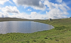
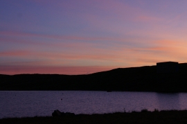
Ladie Loch, Shetland Islands

« Gazetteer Entry
Upload Photo

Ladie Loch, Shetland Islands

  • Unitary Authority: Shetland Islands
  • Region: Scotland
  • Category: Water Feature
  • Type: Other Water Feature
  • Latitude/Longitude: 60°35'43"N 1°10'16"W
  • Eastings/Northings: 445500, 1190500
  • OS Grid: HU455905
  • Mapcode Local: GBR R0GQ.VDB
  • Mapcode Global: XHF7T.5Y8B

Location and coordinates are for the approximate centre of Ladie Loch within this administrative area. Geographic features and populated places may cross administrative borders.

BritishPlaceNames.uk is a Good Stuff website.