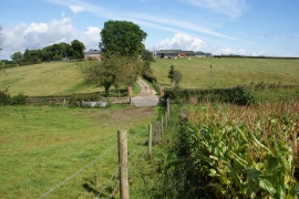
Kerfinch Plantation, Staffordshire

« Gazetteer Entry
Upload Photo

Kerfinch Plantation, Staffordshire

  • Parish/Community: Uttoxeter Rural
  • District/Borough: East Staffordshire
  • County: Staffordshire
  • Region: West Midlands
  • Category: Landcover
  • Type: Forest or Wood
  • Latitude/Longitude: 52°52'40"N 1°53'51"W
  • Eastings/Northings: 406982, 331155
  • OS Grid: SK069311
  • Mapcode Local: GBR 38X.F24
  • Mapcode Global: WHBDJ.TXHP

Location and coordinates are for the approximate centre of Kerfinch Plantation within this administrative area. Geographic features and populated places may cross administrative borders.

BritishPlaceNames.uk is a Good Stuff website.