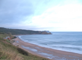
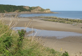
Karl Stones, North Yorkshire

« Gazetteer Entry
Upload Photo

Karl Stones, North Yorkshire

  • Parish/Community: Cayton
  • District/Borough: Scarborough
  • County: North Yorkshire
  • Region: Yorkshire and the Humber
  • Category: Geographic Feature
  • Type: Other Coastal Landform
  • Latitude/Longitude: 54°14'49"N 0°21'53"W
  • Eastings/Northings: 506643, 484734
  • OS Grid: TA066847
  • Mapcode Local: GBR TMWB.S8
  • Mapcode Global: WHGC7.CHHW

Location and coordinates are for the approximate centre of Karl Stones within this administrative area. Geographic features and populated places may cross administrative borders.

BritishPlaceNames.uk is a Good Stuff website.