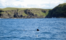
Àird an Eilein, Highland

« Gazetteer Entry
Upload Photo

Àird an Eilein, Highland

  • Unitary Authority: Highland
  • Region: Scotland
  • Category: Geographic Feature
  • Type: Other Coastal Landform
  • Latitude/Longitude: 56°51'5"N 6°16'45"W
  • Eastings/Northings: 139202, 781493
  • OS Grid: NM392814
  • Mapcode Local: GBR BBWM.2LV
  • Mapcode Global: WGY9S.J13Z

Location and coordinates are for the approximate centre of Àird an Eilein within this administrative area. Geographic features and populated places may cross administrative borders.

BritishPlaceNames.uk is a Good Stuff website.