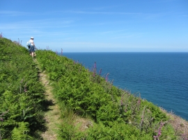
Inner Anchorage, Devon

« Gazetteer Entry
Upload Photo

Inner Anchorage, Devon

  • Parish/Community: Area not comprised in any Parish-Lundy Island
  • District/Borough: Mid Devon
  • County: Devon
  • Region: South West
  • Category: Water Feature
  • Type: Bay
  • Latitude/Longitude: 51°10'13"N 4°39'31"W
  • Eastings/Northings: 214229, 144603
  • OS Grid: SS142446
  • Mapcode Local: GBR GTWL.DRY
  • Mapcode Global: VH2S4.6VG4

Location and coordinates are for the approximate centre of Inner Anchorage within this administrative area. Geographic features and populated places may cross administrative borders.

BritishPlaceNames.uk is a Good Stuff website.