-
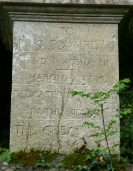
Inscribed plinth of the King Edward VII column, Iford Manor
-
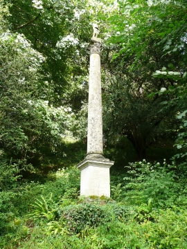
King Edward VII column, Iford Manor
Inscribed plinth of the King Edward VII column, Iford Manor
King Edward VII column, Iford Manor
Location and coordinates are for the approximate centre of Iford Wood within this administrative area. Geographic features and populated places may cross administrative borders.