-
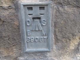
Ordnance Survey Flush Bracket S9067
-
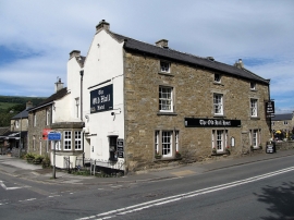
Hope-The Old Hall Hotel
Ordnance Survey Flush Bracket S9067
Hope-The Old Hall Hotel
Location and coordinates are for the approximate centre of Hope within this administrative area. Geographic features and populated places may cross administrative borders.