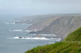
Gunpath Beach, Devon

« Gazetteer Entry
Upload Photo

Gunpath Beach, Devon

  • Parish/Community: Hartland
  • District/Borough: Torridge
  • County: Devon
  • Region: South West
  • Category: Geographic Feature
  • Type: Beach
  • Latitude/Longitude: 50°58'24"N 4°32'4"W
  • Eastings/Northings: 222149, 122406
  • OS Grid: SS221224
  • Mapcode Local: GBR K2.LYYH
  • Mapcode Global: FRA 16DJ.TDY

Location and coordinates are for the approximate centre of Gunpath Beach within this administrative area. Geographic features and populated places may cross administrative borders.

BritishPlaceNames.uk is a Good Stuff website.