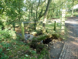
Gill Waite Plantation, North Yorkshire

« Gazetteer Entry
Upload Photo

Gill Waite Plantation, North Yorkshire

  • Parish/Community: Westerdale
  • District/Borough: Scarborough
  • County: North Yorkshire
  • Region: Yorkshire and the Humber
  • Category: Landcover
  • Type: Forest or Wood
  • Latitude/Longitude: 54°25'39"N 0°59'48"W
  • Eastings/Northings: 465178, 504021
  • OS Grid: NZ651040
  • Mapcode Local: GBR PKG7.ZM
  • Mapcode Global: WHF8T.NZH5

Location and coordinates are for the approximate centre of Gill Waite Plantation within this administrative area. Geographic features and populated places may cross administrative borders.

BritishPlaceNames.uk is a Good Stuff website.