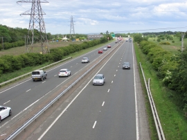
General's Plantation, Fife

« Gazetteer Entry
Upload Photo

General's Plantation, Fife

  • Unitary Authority: Fife
  • Region: Scotland
  • Category: Landcover
  • Type: Forest or Wood
  • Latitude/Longitude: 56°9'7"N 3°8'33"W
  • Eastings/Northings: 329117, 696087
  • OS Grid: NT291960
  • Mapcode Local: GBR 2B.J7YK
  • Mapcode Global: WH6RN.PMQH

Location and coordinates are for the approximate centre of General's Plantation within this administrative area. Geographic features and populated places may cross administrative borders.

BritishPlaceNames.uk is a Good Stuff website.