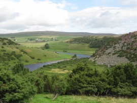
Force Garth Pasture, County Durham

« Gazetteer Entry
Upload Photo

Force Garth Pasture, County Durham

  • Parish/Community: Forest and Frith
  • Unitary Authority: County Durham
  • Region: North East
  • Category: Landcover
  • Type: Other Landcover
  • Latitude/Longitude: 54°39'7"N 2°12'14"W
  • Eastings/Northings: 386936, 528581
  • OS Grid: NY869285
  • Mapcode Local: GBR FG1N.M3
  • Mapcode Global: WHB3W.3BRD

Location and coordinates are for the approximate centre of Force Garth Pasture within this administrative area. Geographic features and populated places may cross administrative borders.

BritishPlaceNames.uk is a Good Stuff website.