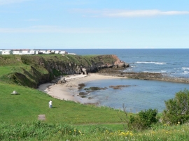
Fisherman's Haven, Carlisle

« Gazetteer Entry
Upload Photo

Fisherman's Haven, Carlisle

  • Built-Up Area: Berwick-upon-Tweed
  • Parish/Community: Berwick-upon-Tweed
  • Unitary Authority: Carlisle
  • Region: North East
  • Category: Water Feature
  • Type: Bay
  • Latitude/Longitude: 55°46'32"N 1°59'42"W
  • Eastings/Northings: 400396, 653600
  • OS Grid: NU003536
  • Mapcode Local: GBR G1HN.TD
  • Mapcode Global: WH9YK.B333

Location and coordinates are for the approximate centre of Fisherman's Haven within this administrative area. Geographic features and populated places may cross administrative borders.

BritishPlaceNames.uk is a Good Stuff website.