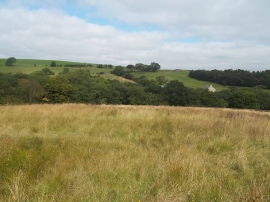
Diglee Reservoir, Derbyshire

« Gazetteer Entry
Upload Photo

Diglee Reservoir, Derbyshire

  • Built-Up Area: Furness Vale
  • Parish/Community: Whaley Bridge
  • District/Borough: High Peak
  • County: Derbyshire
  • Region: East Midlands
  • Category: Water Feature
  • Type: Inland Water
  • Latitude/Longitude: 53°20'39"N 2°0'10"W
  • Eastings/Northings: 399900, 383042
  • OS Grid: SJ999830
  • Mapcode Local: GBR GYGR.4W
  • Mapcode Global: WHBBC.66GJ

Location and coordinates are for the approximate centre of Diglee Reservoir within this administrative area. Geographic features and populated places may cross administrative borders.

BritishPlaceNames.uk is a Good Stuff website.