-
Crossroads, Cwrtnewydd
-

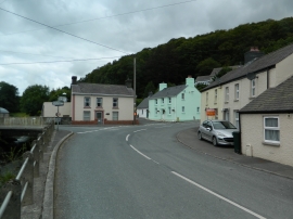
B4338 in centre of Cwrtnewwydd
Crossroads, Cwrtnewydd
B4338 in centre of Cwrtnewwydd
Other current and historical names
Location and coordinates are for the approximate centre of Cwrtnewydd within this administrative area. Geographic features and populated places may cross administrative borders.