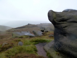
Crowden Clough, Derbyshire

« Gazetteer Entry
Upload Photo

Crowden Clough, Derbyshire

  • Parish/Community: Edale
  • District/Borough: High Peak
  • County: Derbyshire
  • Region: East Midlands
  • Category: Geographic Feature
  • Type: Valley
  • Latitude/Longitude: 53°22'36"N 1°51'6"W
  • Eastings/Northings: 409957, 386682
  • OS Grid: SK099866
  • Mapcode Local: GBR HYHD.W6
  • Mapcode Global: WHCCC.JDD1

Location and coordinates are for the approximate centre of Crowden Clough within this administrative area. Geographic features and populated places may cross administrative borders.

BritishPlaceNames.uk is a Good Stuff website.