-
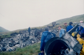
Stob na Boine Druim-fhinn: wreck of a B29 Superfortress
-

Road in Drimsynie Forest
Stob na Boine Druim-fhinn: wreck of a B29 Superfortress
Road in Drimsynie Forest
Location and coordinates are for the approximate centre of Coire A' Chuir within this administrative area. Geographic features and populated places may cross administrative borders.