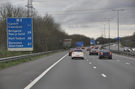
Coed Cefn-llogell, Newport

« Gazetteer Entry
Upload Photo

Coed Cefn-llogell, Newport

  • Parish/Community: Coedkernew
  • Unitary Authority: Newport
  • Region: Wales
  • Category: Landcover
  • Type: Forest or Wood
  • Latitude/Longitude: 51°33'33"N 3°3'6"W
  • Eastings/Northings: 327180, 185019
  • OS Grid: ST271850
  • Mapcode Local: GBR J3.DWKZ
  • Mapcode Global: VH7BK.12ZG

Location and coordinates are for the approximate centre of Coed Cefn-llogell within this administrative area. Geographic features and populated places may cross administrative borders.

BritishPlaceNames.uk is a Good Stuff website.