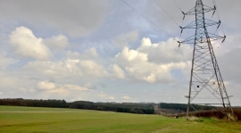
Cocked Hat Plantation, Nottinghamshire

« Gazetteer Entry
Upload Photo

Cocked Hat Plantation, Nottinghamshire

  • Parish/Community: Papplewick
  • District/Borough: Gedling
  • County: Nottinghamshire
  • Region: East Midlands
  • Category: Landcover
  • Type: Forest or Wood
  • Latitude/Longitude: 53°3'54"N 1°10'5"W
  • Eastings/Northings: 455829, 352311
  • OS Grid: SK558523
  • Mapcode Local: GBR 8G5.ZBP
  • Mapcode Global: WHDGD.07X2

Location and coordinates are for the approximate centre of Cocked Hat Plantation within this administrative area. Geographic features and populated places may cross administrative borders.

BritishPlaceNames.uk is a Good Stuff website.