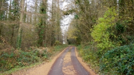
Clappers Wood, Forest of Dean

« Gazetteer Entry
Upload Photo

Clappers Wood, Forest of Dean

  • Parish/Community: Llangattock-Vibon-Avel
  • Unitary Authority: Forest of Dean
  • Region: Wales
  • Category: Landcover
  • Type: Forest or Wood
  • Latitude/Longitude: 51°51'43"N 2°46'36"W
  • Eastings/Northings: 346606, 218468
  • OS Grid: SO466184
  • Mapcode Local: GBR FH.SXGP
  • Mapcode Global: VH794.TGD9

Location and coordinates are for the approximate centre of Clappers Wood within this administrative area. Geographic features and populated places may cross administrative borders.

BritishPlaceNames.uk is a Good Stuff website.