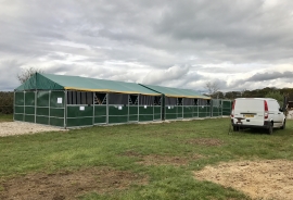
Bullspark Wood, Staffordshire

« Gazetteer Entry
Upload Photo

Bullspark Wood, Staffordshire

  • Parish/Community: Newborough
  • District/Borough: East Staffordshire
  • County: Staffordshire
  • Region: West Midlands
  • Category: Landcover
  • Type: Forest or Wood
  • Latitude/Longitude: 52°51'2"N 1°47'8"W
  • Eastings/Northings: 414531, 328141
  • OS Grid: SK145281
  • Mapcode Local: GBR 4BR.CBC
  • Mapcode Global: WHCFX.JMW0

Location and coordinates are for the approximate centre of Bullspark Wood within this administrative area. Geographic features and populated places may cross administrative borders.

BritishPlaceNames.uk is a Good Stuff website.