-
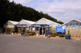
Jubilee Garden Centre at Branstone
-

Isle of Wight Garlic Festival site
Jubilee Garden Centre at Branstone
Isle of Wight Garlic Festival site
Other current and historical names
Location and coordinates are for the approximate centre of Branstone within this administrative area. Geographic features and populated places may cross administrative borders.