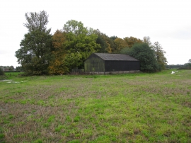
Black Clump, Cheshire East

« Gazetteer Entry
Upload Photo

Black Clump, Cheshire East

  • Parish/Community: Tabley Superior
  • Unitary Authority: Cheshire East
  • Region: North West
  • Category: Landcover
  • Type: Forest or Wood
  • Latitude/Longitude: 53°18'5"N 2°25'26"W
  • Eastings/Northings: 371842, 378359
  • OS Grid: SJ718783
  • Mapcode Local: GBR CZJ8.08
  • Mapcode Global: WH996.Q8XX

Location and coordinates are for the approximate centre of Black Clump within this administrative area. Geographic features and populated places may cross administrative borders.

BritishPlaceNames.uk is a Good Stuff website.