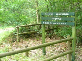
Barberry Furze, West Sussex

« Gazetteer Entry
Upload Photo

Barberry Furze, West Sussex

  • Parish/Community: Plaistow
  • District/Borough: Chichester
  • County: West Sussex
  • Region: South East
  • Category: Landcover
  • Type: Forest or Wood
  • Latitude/Longitude: 51°4'55"N 0°32'51"W
  • Eastings/Northings: 501837, 132425
  • OS Grid: TQ018324
  • Mapcode Local: GBR GGV.0DK
  • Mapcode Global: FRA 96R8.6HR

Location and coordinates are for the approximate centre of Barberry Furze within this administrative area. Geographic features and populated places may cross administrative borders.

BritishPlaceNames.uk is a Good Stuff website.