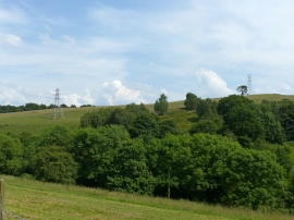
Bank Plantation, Derbyshire

« Gazetteer Entry
Upload Photo

Bank Plantation, Derbyshire

  • Parish/Community: Horsley
  • District/Borough: Amber Valley
  • County: Derbyshire
  • Region: East Midlands
  • Category: Landcover
  • Type: Forest or Wood
  • Latitude/Longitude: 52°59'24"N 1°26'13"W
  • Eastings/Northings: 437892, 343783
  • OS Grid: SK378437
  • Mapcode Local: GBR 6D4.HJ6
  • Mapcode Global: WHDGM.W3WK

Location and coordinates are for the approximate centre of Bank Plantation within this administrative area. Geographic features and populated places may cross administrative borders.

BritishPlaceNames.uk is a Good Stuff website.