-

Llyn Uchaf Talyllychau / Talley Upper Lake
-
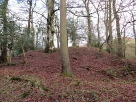
Castell Talyllychau / Talley Mound
Llyn Uchaf Talyllychau / Talley Upper Lake
Castell Talyllychau / Talley Mound
Location and coordinates are for the approximate centre of Allt y Plâs within this administrative area. Geographic features and populated places may cross administrative borders.