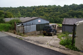
Allt Pen-gegin-isaf, Pembrokeshire

« Gazetteer Entry
Upload Photo

Allt Pen-gegin-isaf, Pembrokeshire

  • Parish/Community: Cwm Gwaun
  • Unitary Authority: Pembrokeshire
  • Region: Wales
  • Category: Landcover
  • Type: Forest or Wood
  • Latitude/Longitude: 51°58'13"N 4°52'6"W
  • Eastings/Northings: 203060, 234103
  • OS Grid: SN030341
  • Mapcode Local: GBR CQ.L12C
  • Mapcode Global: VH1QP.KQLV

Location and coordinates are for the approximate centre of Allt Pen-gegin-isaf within this administrative area. Geographic features and populated places may cross administrative borders.

BritishPlaceNames.uk is a Good Stuff website.