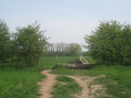
Alder Plantation, Nottinghamshire

« Gazetteer Entry
Upload Photo

Alder Plantation, Nottinghamshire

  • Built-Up Area: Carlton in Lindrick
  • Parish/Community: Carlton in Lindrick
  • District/Borough: Bassetlaw
  • County: Nottinghamshire
  • Region: East Midlands
  • Category: Landcover
  • Type: Forest or Wood
  • Latitude/Longitude: 53°21'14"N 1°5'33"W
  • Eastings/Northings: 460500, 384500
  • OS Grid: SK605845
  • Mapcode Local: GBR NYTN.8F
  • Mapcode Global: WHFG0.6Y0P

Location and coordinates are for the approximate centre of Alder Plantation within this administrative area. Geographic features and populated places may cross administrative borders.

BritishPlaceNames.uk is a Good Stuff website.