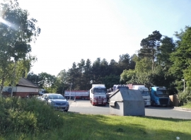
Abbey Heath, Norfolk

« Gazetteer Entry
Upload Photo

Abbey Heath, Norfolk

  • Parish/Community: Thetford
  • District/Borough: Breckland
  • County: Norfolk
  • Region: Eastern
  • Category: Landcover
  • Type: Forest or Wood
  • Latitude/Longitude: 52°25'30"N 0°43'33"E
  • Eastings/Northings: 585441, 284280
  • OS Grid: TL854842
  • Mapcode Local: GBR QBP.Y26
  • Mapcode Global: VHKCC.J9LR

Location and coordinates are for the approximate centre of Abbey Heath within this administrative area. Geographic features and populated places may cross administrative borders.

BritishPlaceNames.uk is a Good Stuff website.